 | Visitor MapKerr Lake |
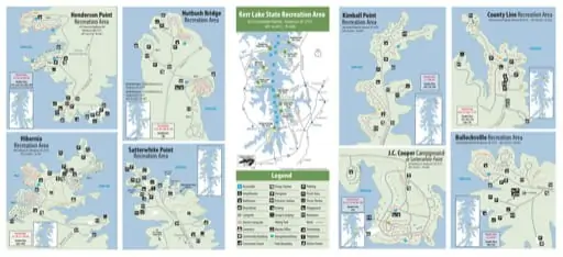
Visitor Map of Kerr Lake State Recreation Area (SRA) in North Carolina. Published by North Carolina State Parks.
featured in
 | North Carolina Pocket Maps |
K
L
65
66
sh Rd.
Nutbu
46
55
57
67
68 69
To Warrenton
44
56
66
70
71
72
73
74
75
76
Middleburg
1
43
42
60
HOST
KERR LAKE
04/20
62
65 64 63
77
78D
Legend
Boat Service
Satterwhite Point
Marina
KERR LAKE
Volleyball
Court
Plantati on Trail
4
13
7
To Henderson
I-85
319
SR 1
Hib
ern
ia R
d.
SR
t Rd.
Poin
hite
er w
Satt
Electric Sites
57–70, 77–110, H1
To
J.C. Cooper
Camp Area
Dump Station
Accessible
Parking
Ampitheater
Dumpster
Picnic Area
Bathhouse
Entrance Station
Picnic Shelter
Boat Ramp
Fishing
Playground
200 Campsite
Group Camping
Restroom
200 Electric Campsite
Hiking Trail
Road
Marina Office
Swimming
Cemetery
Community Building
Concession Stand
J
Navigational Buoy
Telephone
Park Boundary
Visitor Center
2
3
5
7
4
6
KERR LAKE
78
77
73
69
25
70
61
89 93 94 97
98 100
88
102
87
35 36 103
46 47
40
64
63
62
65
60
104
90
34B
27 28
37 38 H3
29 30 32 33 34A
39
72
67
HOST 91 92 95 96 99 101
86
10
6
5
9 8
7
4
23
1
Ball Field
19
85
62
63 64
75 74
14
H1
16 H2
15
H1
61
76
13
23
1
48
49
45 50
43 44A 44B
51
52
41D
58
il
Tra
Bullocksv
11
80
81
82
83
84
2
79
10
20
3
70
nt
Cou
60
9
21
4
21 20
KERR LAKE
8
17
18
66
68
19
22
48 47 45 44 HOST 40D
18
23
38
50
14
37
42 39
36
46
52
24 16 17
35
49
30 29 25 15 12
51
34
13
53
33
54
57
32 31 28
11
58
55D
1
Double Sites
41D
8
7
3050 Bullocksville Park Rd. Manson, NC 27553 GPS: 36.4577, -78.3631
20 Shoreline Ln. Henderson, NC 27537
GPS: 36.4411, -78.3688
Electric Sites
23, 25, 27–65, 80–103
12D
10
Bullocksville Recreation Area
at Satterwhite Point
123
122
121
120
119
118
111
117
116
113 114 115
11
71
Double Sites
12D, 16D, 31D,
54D, 75D
To Raleigh
* Steele Creek Marina is privately owned and independently operated
69
16D
14 15
61
63
Electric Sites
12D–33, 54D–71, H1
85
Fuel Dock
& Store
Area 3
39
38
ail
plar Tr
Big Po
131 132
130
127 128 129
125
124
126
123 122 121 119
120 118 117
113
114 115 116
143
141 142
137 138139
140
67
75D
74
73
72
J.C. Cooper Campground
To Durham
145
144
41
40
Exit 217
Exit 214
65
45
58
Exit 220
73
72
71
21
Double Sites
82D, 105D
And erson
.
Cre e k Rd
P
53
22 21 20
19 18
HOST
H1
6
77
Double Sites
34D, 37D, 78D
47
Rd.
133 136
14 12
16 15 13 10
9 7
64 63 11
17
6
65 62 61 8
27
26
22
66 67 60 59
4
23
28
68
30
5 2
Area 1
24 25
32 69 5857
29
70 3 1
31
38 37 36 34 33
39
35
41 40 55 54
53 52
42
50 51
43
44
48
45 46 47 49
J.C. Cooper
Campground
48
54
Manson
.
19
20
82D
84 81
80 79
78 77
91 92 93
95
HOST
94 96 97
98 99
103 102 101 100
104
105D
107
108 109 110 H1
18
Williamsboro
Nutbush Bridge
Rec. Area
Exit 223
28
58 59
60
62
64
59
te Po int
152
151
149 147
150
148 146
Area 2
77
76
Satterwhite Point
Recreation Area
2041 Hibernia Rd. Henderson, NC 27537
GPS: 36.5047, -78.3761
88
90
75
Double Sites
10D
Hibernia
Recreation Area
O
50
51
52
85
i
erwh
Satt
Electric Sites
1–31, 88–109, H1, H2
89
86 85
N
Area 4
To Richmond
Satterwhite
Point Rec.
Area
M
39
Drewry
KERR LAKE
25
57
1
KERR LAKE
n Rd
tow
i ng
Flem
KERR LAKE
70
Path
lle
ksvi
lloc Rd.
u
B
Bullocksville
Park
Rec. Area
Townsville Landing Rd.
J
61
55
56
32
Electric Sites
31–78D, H1
I
31D
30 29
Ole
Stil
l
Steele Creek
Marina*
54D
23
Park
Rd.
H
31
24
33
i ne
Townsville
.
34D
yL
Rd.
Rd
48 49 50
37D
204
Re
v.
G
ty
200 County Line Park Rd. Manson, NC 27553 GPS: 36.5247, -78.3163
38
37
36
35
34
H1
33
2
n Rd.
59
63
Hibernia
Rec. Area
County Line
Rec. Area
30
4
3
Jacksontow
North Entrance: 115 Jack Wade Farm Ln.
Henderson, NC 27537
South Entrance: 135 Jack Wade Farm Ln.
Henderson NC 27537
GPS: 36.4100, -78.3991
51 52
53
103
54
89 96 104
55
90 97 105
56
106
98
83 91
57
99 107
92
84 85 93 100 108
86 94 101
HOST
109
8788
95
102
F
28
5
North
36
35
int Rd
. SR 1
Spri
H2
nia
E
26
27
11 10
6 78
d.
42
43
44
24
all Po
He
nd
ers
o
Double Sites
21D, 23D, 25D, 60D, 64D
er
Hib
Area 3
n Rd
Electric Sites
35–75, H3, H4, H5
D
14
21
25
16
15
County Line Recreation Area
40
Kimb
d.
hR
SR.
28 29
n g Ch
urch Rd
.
SR 1359
Area 1
Kimball
R
20
19
18
17
12
Drewry VA Line Rd.
21D
26 27
22 23D 24 25
n ia
Virgi
olina
h Car
Nort
22
460 Kimball Point Rd. Manson, NC 27553
GPS: 36.5367, -78.3099
Kimball Point
Rec. Area
C
Henderson
Point Rec. Area
Kimball Point
Recreation Area
13
B
n
Cou e
Li n
18
19
H2 20
18
HOST
14 13 12
11 9
17
8
10D1
16 152
7
1
H1 3 5 6
4
Area 2
To SR 1356
Rock Spring Church Rd.
12 1110 9 8 7
4
13
15
3
1
16 14
H1 2
17
Area 1
6254 Satterwhite Point Rd. Henderson, NC 27537
GPS: 36.4411, -78.3688
Rock
6 5
Chapel
Kerr Lake State Recreation Area
Rd
.
1427 Reverend Henderson Rd.
Henderson, NC 27537
GPS: 36.5312, -78.3461
Nutbush Bridge
Recreation Area
Nu
tbu
s
KERR LAKE
25 24 23
26 27
22
21
28 29
30
20 19
31
Buc
han
an
Henderson Point
Recreation Area
40 38 37 36 35 HOST
43 42
39
44 41
Area 2
45
75
46
H3 H4
50
74
47
48
73
55 56
65
72
57
71
49
66
70
51 52D 54 58
59
64D 67 68 69 H5
60D 61 62 63
59
57
56
Electric Sites
34–64, H1
54
Double Sites
40D, 55D
ille Park Rd.


